National Geographic
Jasper North: Map #903
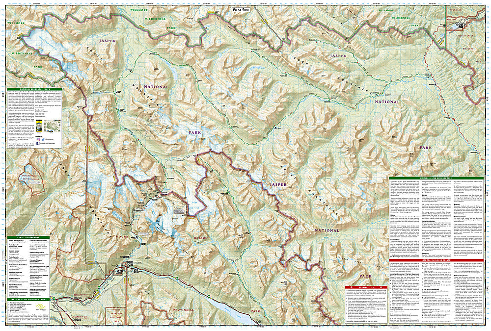
Jasper North: Map #903
Couldn't load pickup availability
National Geographic Trails Illustrated Jasper North Map #903 — waterproof, tear-resistant. Coverage of the northern section of Jasper National Park including the Willmore Wilderness, Tonquin Valley, and surrounding Canadian Rockies terrain in Alberta. GPS-compatible.
The National Geographic Trails Illustrated Jasper North Map covers the northern section of Jasper National Park — the Tonquin Valley (one of the most spectacular backcountry destinations in the Canadian Rockies), the Willmore Wilderness boundary, the Athabasca River corridor, and surrounding wilderness terrain. Trails, backcountry campsites, wilderness boundaries, and GPS coordinates are mapped in detail.
Key specs
- SKU: NGTI903
- Map number: 903
- Coverage: Jasper National Park North, Alberta, Canada
- Material: Waterproof, tear-resistant paper
- Features: Trails, Tonquin Valley, Willmore Wilderness, Athabasca River, backcountry campsites, GPS coordinates
Why it works
The Tonquin Valley's Amethyst Lakes and the Ramparts — a dramatic wall of quartzite peaks — make it one of the most photographed backcountry destinations in Canada, requiring accurate trail and campsite mapping for the multi-day approach. The northern Jasper backcountry's remote terrain and the Willmore Wilderness boundary require detailed mapping for safe navigation. Waterproof construction survives the Canadian Rockies' frequent rain and the variable weather common in Jasper's high-altitude terrain.
Ideal for
Backpackers, hikers, and wilderness lovers exploring the Tonquin Valley, northern Jasper National Park, and Willmore Wilderness in Alberta. See also NGTI901 (Banff North) for adjacent coverage to the south.
Share