National Geographic
Idaho Springs & Loveland Pass: Map #104
Idaho Springs & Loveland Pass: Map #104
Couldn't load pickup availability
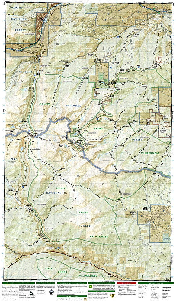
National Geographic Trails Illustrated Idaho Springs & Loveland Pass Map #104 — waterproof, tear-resistant, scale 1:63,360. Coverage of Idaho Springs, Loveland Pass, Arapaho National Forest, and the Mount Evans Wilderness. GPS-compatible.
The National Geographic Trails Illustrated Idaho Springs & Loveland Pass Map covers the Idaho Springs area, Loveland Pass, the Mount Evans Wilderness, and surrounding Arapaho National Forest in the Colorado Front Range. Trails, the Mount Evans road and summit route, ski area terrain, trailheads, and GPS coordinates are mapped in detail.
Key specs
- SKU: NGTI104
- Map number: 104
- Scale: 1:63,360
- Coverage: Idaho Springs & Loveland Pass area, Colorado (Front Range)
- Material: Waterproof, tear-resistant paper
- Features: Trails, Mount Evans routes, Loveland Pass, ski terrain, trailheads, GPS coordinates
Why it works
The Idaho Springs and Loveland Pass area sits at the gateway to the Colorado high country from Denver, making it one of the most frequently visited sections of the Front Range. Mount Evans is one of the most accessible 14ers in Colorado via the highest paved road in North America, but the surrounding wilderness trails require detailed topo mapping for safe navigation. Waterproof construction survives the afternoon thunderstorms common on the exposed ridgelines above Idaho Springs.
Ideal for
Hikers, mountaineers, and skiers exploring the Idaho Springs area, Loveland Pass, and Mount Evans Wilderness. See also NGTI103 (Winter Park, Central City) for adjacent coverage to the northwest.
Share