National Geographic
Hahns Peak & Steamboat Lake: Map #116
Hahns Peak & Steamboat Lake: Map #116
Couldn't load pickup availability
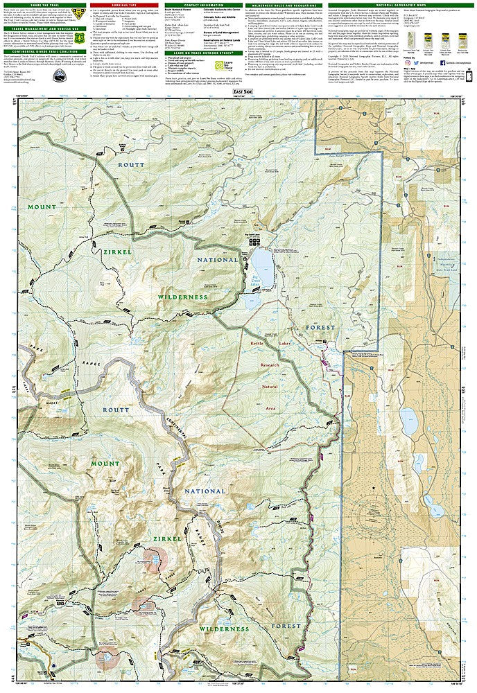
National Geographic Trails Illustrated Hahns Peak & Steamboat Lake Map #116 — waterproof, tear-resistant, scale 1:63,360. Coverage of Hahns Peak, Steamboat Lake State Park, Mount Zirkel Wilderness, and surrounding Routt National Forest. GPS-compatible.
The National Geographic Trails Illustrated Hahns Peak & Steamboat Lake Map covers the Hahns Peak volcanic area, Steamboat Lake State Park, the northern Mount Zirkel Wilderness, and surrounding Routt National Forest in northwest Colorado. Trails, lake access, wilderness boundaries, trailheads, and GPS coordinates are mapped in detail.
Key specs
- SKU: NGTI116
- Map number: 116
- Scale: 1:63,360
- Coverage: Hahns Peak & Steamboat Lake area, Colorado (Routt National Forest)
- Material: Waterproof, tear-resistant paper
- Features: Trails, Steamboat Lake access, Mount Zirkel Wilderness, trailheads, GPS coordinates
Why it works
The Hahns Peak and Steamboat Lake area covers the northern end of the Mount Zirkel Wilderness and the popular Steamboat Lake State Park — a combination of backcountry wilderness and developed recreation that requires a map covering both. Hahns Peak's distinctive volcanic cone is a popular day hike with a trail that requires accurate topo detail for navigation. Waterproof construction survives the rain and early-season snow common in northwest Colorado's high country.
Ideal for
Hikers, backpackers, anglers, and campers exploring Hahns Peak, Steamboat Lake State Park, and the northern Mount Zirkel Wilderness. See also NGTI117 (Clark, Buffalo Pass) for adjacent coverage to the south.
Share