National Geographic
Grand Teton National Park: Map #202
Grand Teton National Park: Map #202
Couldn't load pickup availability
National Geographic Trails Illustrated Grand Teton National Park Map #202 — waterproof, tear-resistant. Full coverage of Grand Teton National Park including the Teton Range, Jackson Hole, climbing routes, and backcountry trails. GPS-compatible.
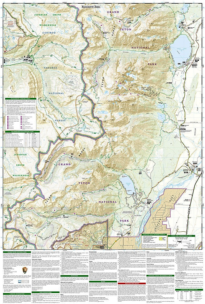
The National Geographic Trails Illustrated Grand Teton National Park Map covers the full park — the Teton Range from the Cathedral Group to the Jedediah Smith Wilderness, Jackson Hole valley, Jenny Lake, the Death Canyon and Cascade Canyon drainages, and all major climbing routes. Trails, backcountry campsites, climbing routes, and GPS coordinates are mapped in detail.
Key specs
- SKU: NGTI202
- Map number: 202
- Coverage: Grand Teton National Park, Wyoming
- Material: Waterproof, tear-resistant paper
- Features: Trails, Teton Range climbing routes, backcountry campsites, Jenny Lake, canyon drainages, GPS coordinates
Why it works
The Teton Range rises abruptly 7,000 feet above Jackson Hole with no foothills — the dramatic vertical relief makes accurate topographic mapping essential for both hikers navigating the canyon trails and climbers approaching the technical routes on the Cathedral Group peaks. The backcountry permit system requires knowing exactly which campsites are available in each drainage. Waterproof construction survives the afternoon thunderstorms that are a constant hazard on the Teton peaks.
Ideal for
Hikers, backpackers, climbers, and park visitors exploring Grand Teton National Park's trails, canyons, and climbing routes. See also NGTIB052 (Yellowstone & Grand Teton Bundle) for combined park coverage.
Share