National Geographic
Goat Rocks & Norse Peak Wilderness: Map #823
Goat Rocks & Norse Peak Wilderness: Map #823
Couldn't load pickup availability
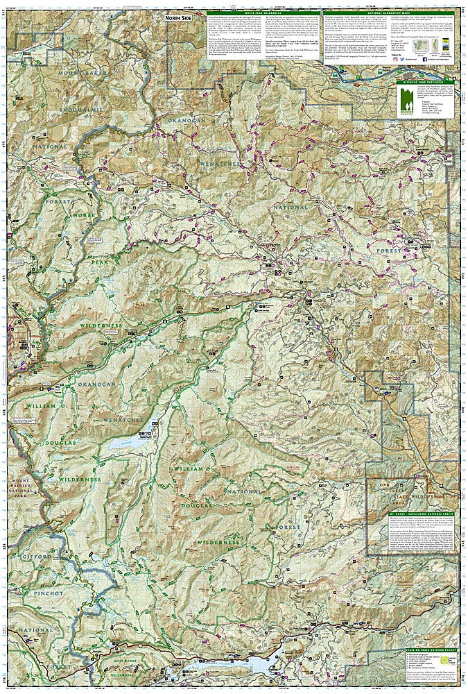
National Geographic Trails Illustrated Goat Rocks & Norse Peak Wilderness Map #823 — waterproof, tear-resistant. Coverage of the Goat Rocks Wilderness, Norse Peak Wilderness, and surrounding Gifford Pinchot and Mount Baker-Snoqualmie National Forests in Washington. GPS-compatible.
The National Geographic Trails Illustrated Goat Rocks & Norse Peak Wilderness Map covers the Goat Rocks Wilderness south of Mount Rainier and the Norse Peak Wilderness to the northeast, including the Pacific Crest Trail corridor through both wilderness areas. Trails, PCT route, wilderness boundaries, trailheads, and GPS coordinates are mapped in detail.
Key specs
- SKU: NGTI823
- Map number: 823
- Coverage: Goat Rocks & Norse Peak Wilderness, Washington
- Material: Waterproof, tear-resistant paper
- Features: Trails, PCT corridor, Goat Rocks & Norse Peak Wilderness, trailheads, GPS coordinates
Why it works
The Goat Rocks Wilderness contains one of the most scenic sections of the Pacific Crest Trail in Washington — the high ridge traverse above the Packwood Glacier with views of Mount Rainier and Mount Adams — making accurate PCT and trail detail essential for hikers and PCT thru-hikers. The Norse Peak Wilderness offers accessible backcountry from the Crystal Mountain area. Waterproof construction survives the Cascades' frequent rain and the snow that can fall at any time of year on the high ridges.
Ideal for
PCT hikers, backpackers, and wilderness lovers exploring the Goat Rocks and Norse Peak Wilderness areas in Washington. See also NGTI217 (Mount Rainier National Park) for adjacent coverage to the north.
Share