National Geographic
Glacier & Waterton National Parks Wall Map - Tubed (24" x 36")
Glacier & Waterton National Parks Wall Map - Tubed (24" x 36")
Couldn't load pickup availability
National Geographic Glacier & Waterton National Parks Wall Map — Tubed, 24" x 36". Trails Illustrated base cartography. Ships rolled in a cardboard tube.
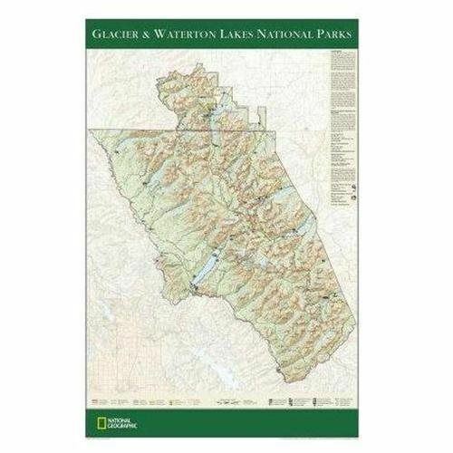
The Glacier & Waterton National Parks Wall Map covers both Glacier National Park (Montana) and Waterton Lakes National Park (Alberta) — together forming the Waterton-Glacier International Peace Park. Detailed mountain terrain, pristine lakes, Going-to-the-Sun Road, major hiking trails, campgrounds, and visitor facilities are all shown with National Geographic's trusted cartographic detail at a scale readable from the wall.
Key specs
- SKU: NGWM201
- Size: 24" x 36"
- Format: Tubed (rolled, ships in cardboard tube)
- Material: High-quality paper print
- Series: Trails Illustrated Wall Map
- Coverage: Glacier NP (MT) & Waterton Lakes NP (AB)
Why it works
Glacier and Waterton together form one of the most spectacular mountain park complexes in North America. A large-format wall map captures the full scope of both parks — the Going-to-the-Sun Road corridor, 700+ miles of trails, and the dramatic Continental Divide terrain — in a format that works for both trip planning and wall display. The tubed format provides protected shipping, making it a great gifting option.
Ideal for
Trip planning, home or office display, and as a gift for Glacier and Waterton visitors and mountain enthusiasts. See also the Standard edition (NGWM200).
Share