National Geographic
Glacier & Waterton Lakes National Parks: Map #215
Glacier & Waterton Lakes National Parks: Map #215
Couldn't load pickup availability
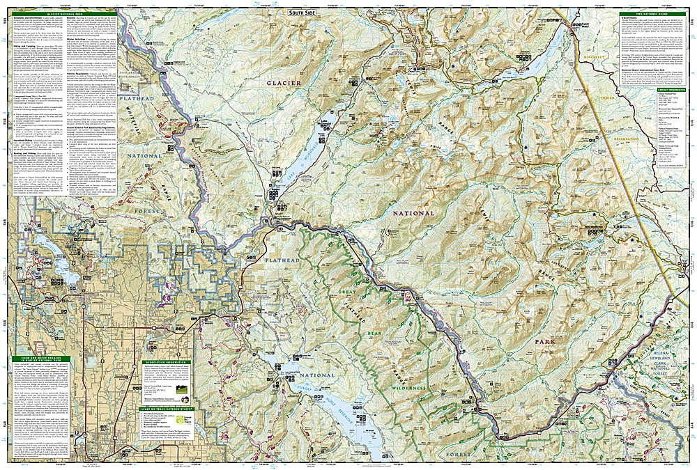
National Geographic Trails Illustrated Glacier & Waterton Lakes National Parks Map #215 — waterproof, tear-resistant. Full coverage of Glacier National Park and Waterton Lakes National Park including Going-to-the-Sun Road, backcountry trails, and the international peace park. GPS-compatible.
The National Geographic Trails Illustrated Glacier & Waterton Lakes National Parks Map covers both parks in the Waterton-Glacier International Peace Park — Going-to-the-Sun Road, Logan Pass, the Highline Trail, Many Glacier, Two Medicine, and the Waterton townsite. Trails, backcountry campsites, lake access, and GPS coordinates are mapped in detail.
Key specs
- SKU: NGTI215
- Map number: 215
- Coverage: Glacier National Park (MT) & Waterton Lakes National Park (Alberta) — full park coverage
- Material: Waterproof, tear-resistant paper
- Features: Going-to-the-Sun Road, Highline Trail, backcountry campsites, lake access, GPS coordinates
Why it works
Glacier and Waterton Lakes together form one of the most spectacular wilderness areas in North America, spanning the US-Canada border — a single map covering both parks provides complete coverage of the international peace park without the need to source maps from two different countries. The Going-to-the-Sun Road corridor and the Highline Trail are the park's most popular routes, requiring accurate trail and facility detail for planning visits. Waterproof construction survives Glacier's frequent rain and the early-season snow common in the northern Rockies.
Ideal for
Hikers, backpackers, and park visitors exploring Glacier and Waterton Lakes National Parks. See also NGTI313 (North Fork) and NGTI314 (Many Glacier, Waterton Lakes) for individual section coverage, and NGTIB051 (Glacier & Waterton Bundle) for the multi-map set.
Share