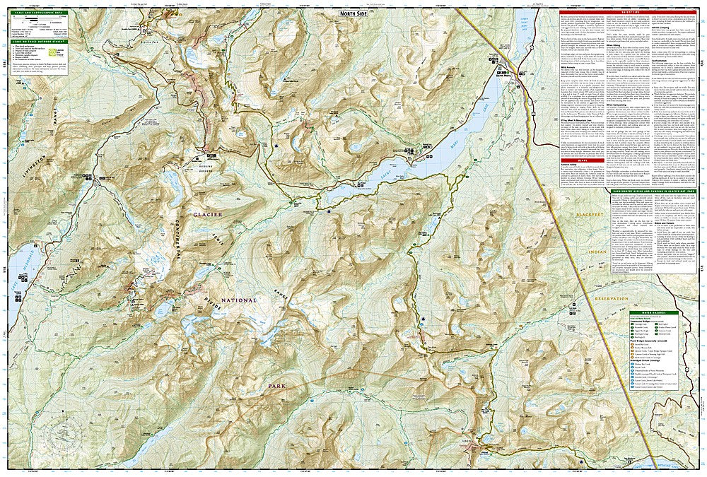
National Geographic Trails Illustrated Glacier & Waterton Lakes National Parks Map Bundle — waterproof, tear-resistant, detailed topography, trails, backcountry routes, and park infrastructure. For hikers, backpackers, and park visitors.
The National Geographic Glacier & Waterton Lakes Map Bundle includes the Trails Illustrated maps covering both Glacier National Park and Waterton Lakes National Park — the two parks that form the Waterton-Glacier International Peace Park. Detailed topography, trail networks, backcountry campsites, and park infrastructure on waterproof, tear-resistant paper.
Key specs
SKU: NGTIB051
Coverage: Glacier National Park (MT) and Waterton Lakes National Park (Alberta)
Material: Waterproof, tear-resistant paper
Features: Detailed topography, trails, backcountry campsites, park infrastructure
Format: Multi-map bundle
Why it works
Glacier and Waterton Lakes together form one of the most spectacular wilderness areas in North America, spanning the US-Canada border. A bundle covering both parks in one purchase provides complete coverage of the international peace park without the need to source maps from two different countries. The backcountry campsite detail is essential for planning permitted overnight trips in Glacier's heavily regulated backcountry. Waterproof construction survives the rain and snow common in the Northern Rockies year-round.
Ideal for
Hikers, backpackers, and park visitors exploring Glacier and Waterton Lakes National Parks. See also NGTI315 (Many Glacier, Waterton Lakes) for individual map coverage.