National Geographic
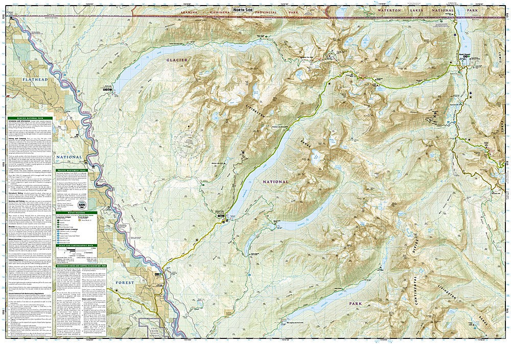
Glacier National Park - North Fork: Map #313
Glacier National Park - North Fork: Map #313
Couldn't load pickup availability
National Geographic Trails Illustrated Glacier National Park North Fork Map #313 — waterproof, tear-resistant. Coverage of the North Fork area of Glacier National Park including Bowman Lake, Kintla Lake, and the remote northwestern backcountry. GPS-compatible.
The National Geographic Trails Illustrated Glacier National Park North Fork Map covers the remote northwestern section of Glacier National Park — the North Fork of the Flathead River corridor, Bowman Lake, Kintla Lake, and the surrounding backcountry. Trails, backcountry campsites, lake access, and GPS coordinates are mapped in detail.
Key specs
- SKU: NGTI313
- Map number: 313
- Coverage: Glacier National Park North Fork area, Montana
- Material: Waterproof, tear-resistant paper
- Features: Trails, Bowman Lake, Kintla Lake, North Fork corridor, backcountry campsites, GPS coordinates
Why it works
The North Fork area is the least visited and most remote section of Glacier National Park — accessible only via unpaved roads and offering backcountry experiences far from the crowds of the Going-to-the-Sun Road corridor. Bowman and Kintla Lakes are premier backcountry destinations requiring accurate trail and campsite detail for planning permitted overnight trips. Waterproof construction survives Glacier's frequent rain and the early-season snow common in the northern Rockies. See also NGTI215 (Glacier & Waterton Lakes) for broader park coverage.
Ideal for
Backpackers, anglers, and wilderness lovers exploring the remote North Fork area of Glacier National Park. See also NGTI314 (Many Glacier, Waterton Lakes) for the northeastern section coverage.
Share