National Geographic
Flat Tops Wilderness North CO Waterproof Topo Map Hiking Camping Trail #150
Flat Tops Wilderness North CO Waterproof Topo Map Hiking Camping Trail #150
Couldn't load pickup availability
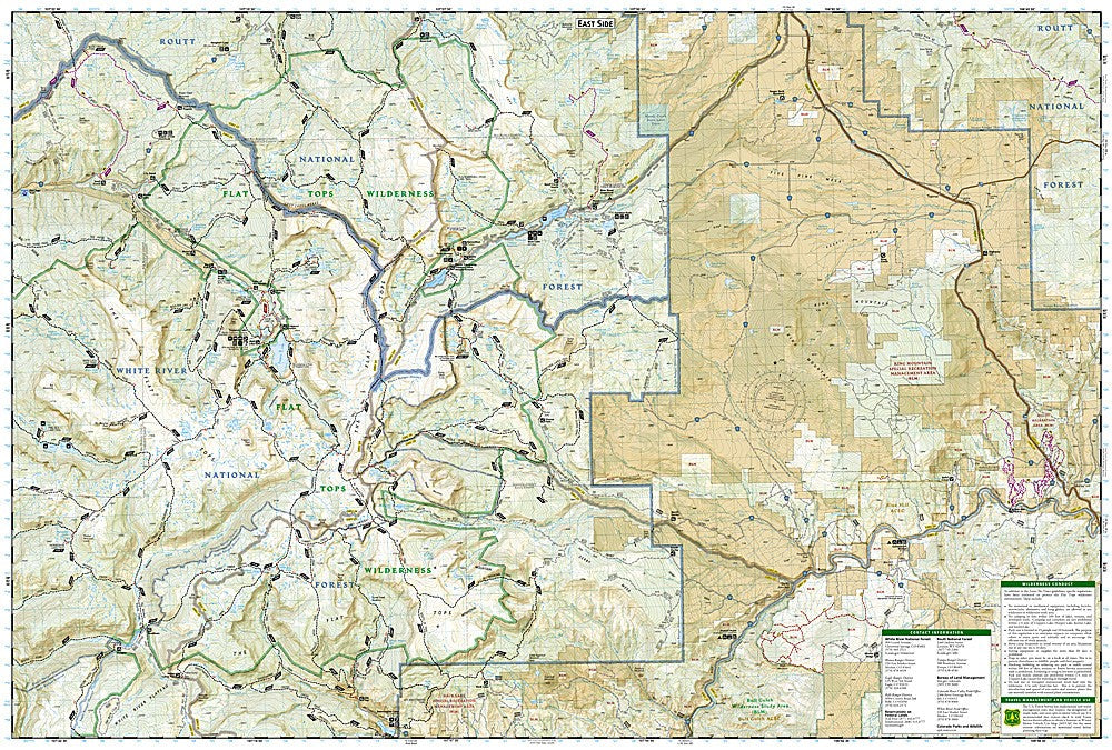
National Geographic Trails Illustrated Flat Tops Wilderness North Map #150 — waterproof, tear-resistant, scale 1:63,360. Coverage of the northern Flat Tops Wilderness in the White River National Forest, northwest Colorado. GPS-compatible.
The National Geographic Trails Illustrated Flat Tops Wilderness North Map covers the northern section of the Flat Tops Wilderness — Colorado's second-largest wilderness area — in the White River National Forest. The high basalt plateaus, alpine lakes, and trail network of the northern Flat Tops are mapped in detail with wilderness boundaries, trailheads, and GPS coordinates.
Key specs
- SKU: NGTI150
- Map number: 150
- Scale: 1:63,360
- Coverage: Flat Tops Wilderness North, White River National Forest, Colorado
- Material: Waterproof, tear-resistant paper
- Features: Trails, alpine lakes, wilderness boundaries, trailheads, GPS coordinates
Why it works
The Flat Tops Wilderness's high basalt plateau terrain is unlike any other wilderness area in Colorado — the flat, lake-dotted plateau makes navigation by terrain features difficult, making accurate topographic mapping essential for safe route-finding. The northern section contains some of the wilderness's most remote and least-visited terrain. Waterproof construction survives the afternoon thunderstorms and early-season snow common on the Flat Tops' exposed plateau.
Ideal for
Backpackers, anglers, hunters, and wilderness lovers exploring the northern Flat Tops Wilderness in northwest Colorado. See also NGTI151 (Flat Tops Wilderness South) for the southern section and NGTIB220 (Flat Tops GMU Bundle) for hunting coverage.
Share