National Geographic
Everglades National Park FL Waterproof Topo Map Hiking Kayaking Camping #243
Everglades National Park FL Waterproof Topo Map Hiking Kayaking Camping #243
Couldn't load pickup availability
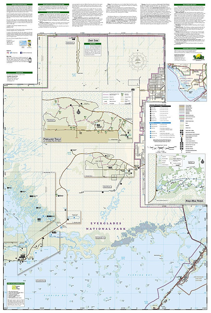
National Geographic Trails Illustrated Everglades National Park Map #243 — waterproof, tear-resistant. Coverage of Everglades National Park including canoe trails, hiking paths, wildlife viewing areas, campgrounds, and the surrounding Big Cypress National Preserve in Florida. GPS-compatible.
The National Geographic Trails Illustrated Everglades National Park Map covers the full park — the Anhinga Trail, Shark Valley, Flamingo, the Ten Thousand Islands, canoe trails, and surrounding Big Cypress National Preserve. Canoe routes, hiking trails, campgrounds, wildlife viewing areas, and GPS coordinates are mapped in detail.
Key specs
- SKU: NGTI243
- Map number: 243
- Coverage: Everglades National Park & surrounding Big Cypress NP, Florida
- Material: Waterproof, tear-resistant paper
- Features: Canoe trails, hiking paths, wildlife viewing areas, campgrounds, GPS coordinates
Why it works
The Everglades' vast, flat landscape of sawgrass prairies, mangrove forests, and waterways is notoriously difficult to navigate without a detailed map — the canoe trail network and backcountry campsite locations are essential for planning multi-day paddling trips in the Ten Thousand Islands and Wilderness Waterway. Wildlife viewing areas for alligators, manatees, and birds require accurate location detail. Waterproof construction is essential in the Everglades' humid, wet environment where standard paper maps deteriorate quickly.
Ideal for
Paddlers, hikers, wildlife watchers, and park visitors exploring Everglades National Park's canoe trails, wildlife areas, and backcountry in Florida. See also NGTI402 (Marco Island, Ten Thousand Islands) for adjacent coastal coverage.
Share