National Geographic
Elevenmile Canyon South Park CO Waterproof Topo Map Hiking Camping Trail #152
Elevenmile Canyon South Park CO Waterproof Topo Map Hiking Camping Trail #152
Couldn't load pickup availability
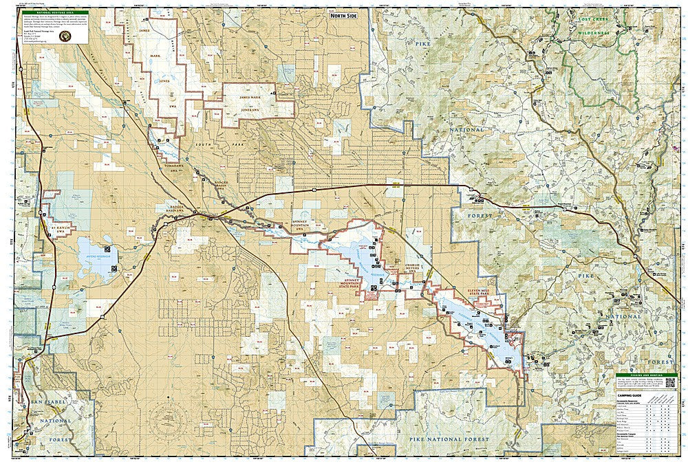
National Geographic Trails Illustrated Elevenmile Canyon & South Park Map #152 — waterproof, tear-resistant, scale 1:40,680. Coverage of Elevenmile Canyon Recreation Area, South Park Basin, Elevenmile and Spinney Mountain State Parks, Lost Creek Wilderness, and surrounding Pike National Forest. GPS-compatible.
The National Geographic Trails Illustrated Elevenmile Canyon & South Park Map covers central Colorado's high-country basin and canyon recreation area — Elevenmile Canyon, South Park, Elevenmile State Park & Reservoir, Spinney Mountain State Park & Reservoir, the Lost Creek Wilderness, and surrounding Pike National Forest. Hiking, biking, and equestrian trails, campgrounds, fishing access, boat ramps, and GPS coordinates are mapped in detail.
Key specs
- SKU: NGTI152
- Map number: 152
- Scale: 1:40,680
- Folded size: 4.25" x 9.25"
- Flat size: 26" x 38"
- Coverage: Elevenmile Canyon & South Park, Colorado
- Material: Waterproof, tear-resistant paper
- Features: Trails, campgrounds, fishing access, boat ramps, reservoir coverage, GPS coordinates
Why it works
South Park and Elevenmile Canyon are among Colorado's premier fishing destinations, with two major reservoirs and the canyon's gold-medal trout water requiring detailed access point and boat ramp mapping. The Lost Creek Wilderness's unique granite formations and trail network add significant hiking coverage. Waterproof construction survives the afternoon thunderstorms and variable weather common in Colorado's high-country basins.
Ideal for
Anglers, hikers, campers, and boaters exploring Elevenmile Canyon, South Park, and the Lost Creek Wilderness in central Colorado. See also NGTI105 (Tarryall Mountains, Kenosha Pass) for adjacent coverage to the north.
Share