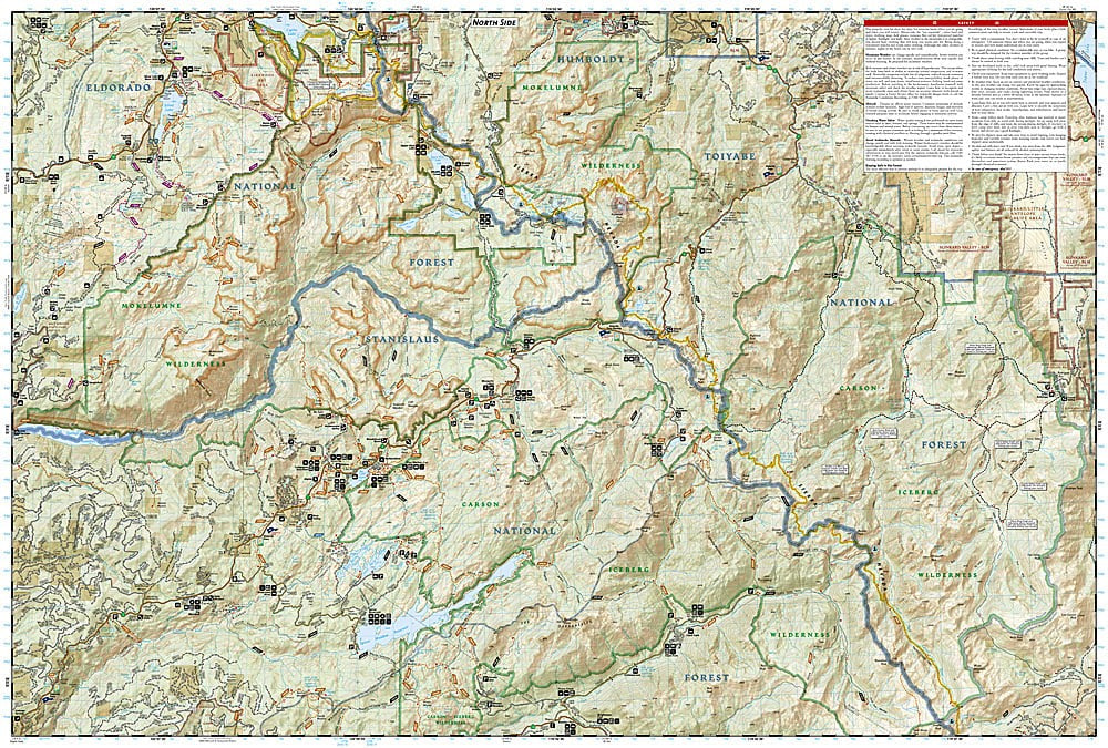
National Geographic Trails Illustrated Eldorado National Forest Map Pack Bundle — waterproof, tear-resistant, detailed topography, hiking and OHV trails, campgrounds, fishing access, and wilderness areas. For hikers, campers, and anglers in the central Sierra Nevada foothills.
The National Geographic Eldorado National Forest Map Pack Bundle includes the Trails Illustrated maps covering the Eldorado National Forest — the Mokelumne Wilderness, Desolation Wilderness boundary, and surrounding forest lands west of Lake Tahoe in the California gold country. Detailed topography, trail networks, OHV routes, campgrounds, and fishing access on waterproof, tear-resistant paper.
Key specs
- SKU: NGTIB301
- Coverage: Eldorado National Forest, California (central Sierra Nevada foothills)
- Material: Waterproof, tear-resistant paper
- Features: Detailed topography, hiking and OHV trails, campgrounds, fishing access, wilderness areas
- Format: Multi-map bundle
Why it works
Eldorado National Forest spans a large area of the central Sierra Nevada foothills with a mix of wilderness areas, OHV zones, reservoirs, and developed campgrounds that require different maps for complete coverage. The forest's proximity to Sacramento and the Bay Area makes it a popular weekend destination where trail and road detail beyond what a standard forest map provides is essential. Waterproof construction survives the Sierra Nevada's afternoon thunderstorms and stream crossings.
Ideal for
Hikers, campers, anglers, and OHV riders exploring the Eldorado National Forest and its wilderness areas west of Lake Tahoe. See also NGTIB241 (Tahoe National Forest Bundle) for adjacent coverage.