National Geographic
El Yunque National Forest: Map #790
El Yunque National Forest: Map #790
Couldn't load pickup availability
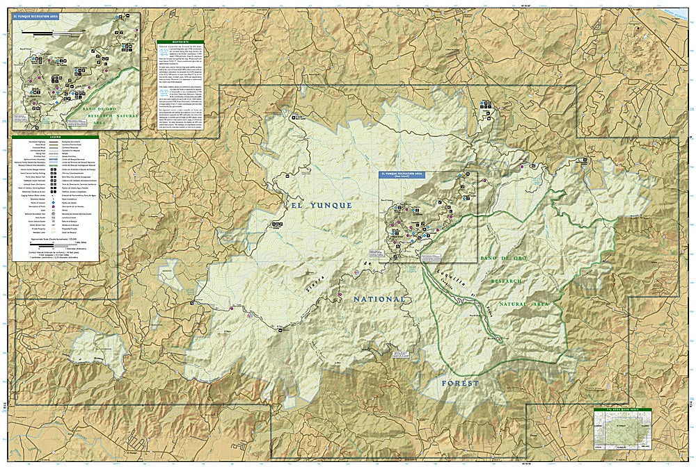
National Geographic Trails Illustrated El Yunque National Forest Map #790 — waterproof, tear-resistant. Coverage of El Yunque National Forest — the only tropical rainforest in the US National Forest system — in Puerto Rico. GPS-compatible.
The National Geographic Trails Illustrated El Yunque National Forest Map covers the full El Yunque National Forest in northeastern Puerto Rico — the only tropical rainforest in the US National Forest system. Trails, waterfalls, swimming holes, recreation areas, trailheads, and GPS coordinates are mapped in detail.
Key specs
- SKU: NGTI790
- Map number: 790
- Coverage: El Yunque National Forest, Puerto Rico
- Material: Waterproof, tear-resistant paper
- Features: Trails, waterfalls, swimming holes, recreation areas, trailheads, GPS coordinates
Why it works
El Yunque's dense tropical forest, frequent rain, and network of trails to waterfalls and peaks make a waterproof map essential — standard paper maps deteriorate quickly in the rainforest's humidity and rainfall. The trail network is more complex than most visitors expect, with multiple routes to the same destinations requiring accurate mapping to avoid getting lost. Waterproof construction is particularly critical in El Yunque, where rain can fall at any time and trails are frequently wet.
Ideal for
Hikers, nature lovers, and visitors exploring El Yunque National Forest's trails, waterfalls, and tropical rainforest in Puerto Rico. See also NGTI236 (St. John, Virgin Islands) for nearby Caribbean coverage.
Share