National Geographic
Durango Cortez CO Waterproof Topographic Map Hiking Camping Trail Guide #144
Durango Cortez CO Waterproof Topographic Map Hiking Camping Trail Guide #144
Couldn't load pickup availability
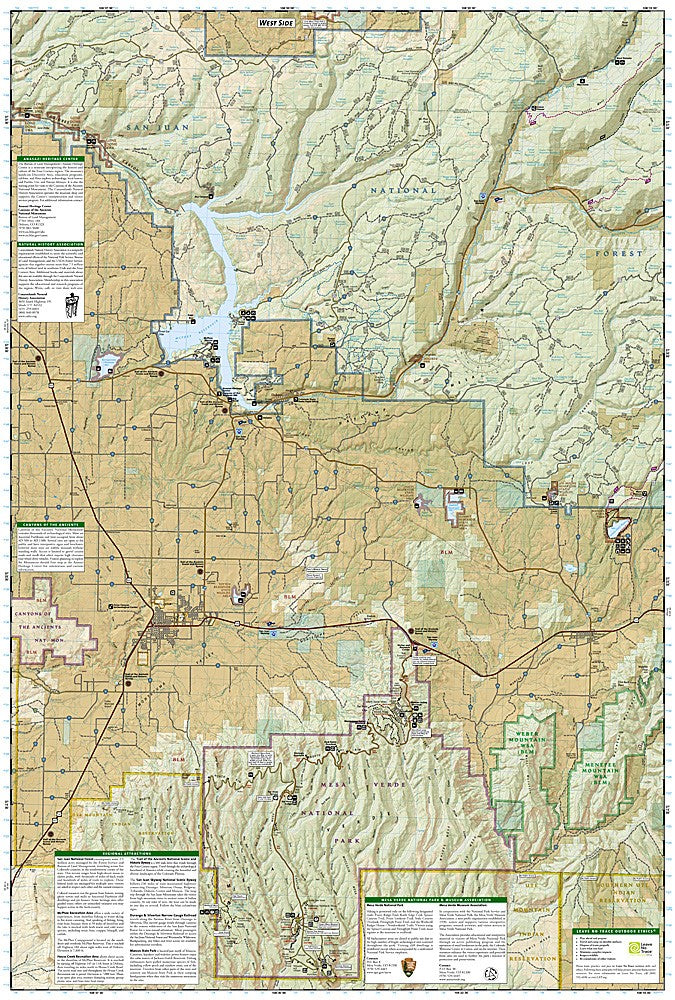
National Geographic Trails Illustrated Durango & Cortez Map #144 — waterproof, tear-resistant, scale 1:63,360. Coverage of the Durango and Cortez area including San Juan National Forest, Mesa Verde National Park, La Plata Mountains, McPhee Reservoir, and Canyons of the Ancients. GPS-compatible.
The National Geographic Trails Illustrated Durango & Cortez Map covers southwest Colorado's most diverse outdoor and cultural landscape — San Juan National Forest, Mesa Verde National Park, La Plata Mountains, McPhee Reservoir, Animas River Valley, and Canyons of the Ancients National Monument. Trails, campgrounds, scenic byways, fishing access, and GPS coordinates are mapped in detail.
Key specs
- SKU: NGTI144
- Map number: 144
- Scale: 1:63,360
- Coverage: Durango & Cortez area, Colorado (San Juan NF, Mesa Verde NP)
- Material: Waterproof, tear-resistant paper
- Features: Trails, Mesa Verde NP, La Plata Mountains, McPhee Reservoir, scenic byways, GPS coordinates
Why it works
The Durango-Cortez corridor combines world-class hiking in the La Plata Mountains, cliff dwelling exploration at Mesa Verde, and fishing at McPhee Reservoir in a single map area — a map covering all three activities is more practical than managing separate maps for each destination. The Animas River Valley and the Durango & Silverton Narrow Gauge Railroad corridor add significant recreation and tourism coverage. Waterproof construction survives the San Juan Mountains' afternoon thunderstorms.
Ideal for
Hikers, cultural heritage visitors, anglers, and outdoor enthusiasts exploring the Durango and Cortez area's national forest, national park, and recreation areas in southwest Colorado. See also NGTI145 (Pagosa Springs, Bayfield) for adjacent coverage to the east.
Share