National Geographic
Delmarva Peninsula: Map #772
Delmarva Peninsula: Map #772
Couldn't load pickup availability
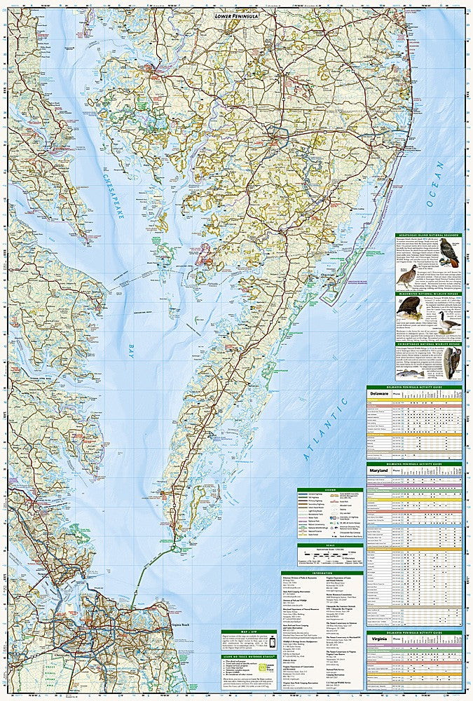
National Geographic Trails Illustrated Delmarva Peninsula Map #772 — waterproof, tear-resistant. Coverage of the Delmarva Peninsula including Assateague Island National Seashore, Chincoteague National Wildlife Refuge, and surrounding coastal areas in Maryland, Virginia, and Delaware. GPS-compatible.
The National Geographic Trails Illustrated Delmarva Peninsula Map covers the Delmarva Peninsula's coastal recreation areas including Assateague Island National Seashore, Chincoteague National Wildlife Refuge, Delaware Seashore State Park, and surrounding bay and ocean shoreline. Trails, beach access, wildlife viewing areas, campgrounds, and GPS coordinates are mapped in detail.
Key specs
- SKU: NGTI772
- Map number: 772
- Coverage: Delmarva Peninsula (MD, VA, DE) including Assateague Island & Chincoteague
- Material: Waterproof, tear-resistant paper
- Features: Trails, beach access, wildlife viewing, campgrounds, Assateague & Chincoteague coverage, GPS coordinates
Why it works
Assateague Island and Chincoteague are among the most popular coastal destinations on the East Coast, attracting visitors for wild pony viewing, beach camping, and birding — a map covering both the Maryland and Virginia sections of Assateague along with the surrounding Delmarva coastal areas provides complete coverage for peninsula visitors. The barrier island geography changes frequently with storms, making an accurate map essential for navigation. Waterproof construction is essential in a coastal environment where salt spray and rain are constant.
Ideal for
Beachgoers, birders, campers, and wildlife watchers exploring Assateague Island, Chincoteague, and the Delmarva Peninsula's coastal areas. See also NGTI737 (Delaware Water Gap) for inland Mid-Atlantic coverage.
Share