National Geographic
Delaware Water Gap: Map #737
Delaware Water Gap: Map #737
Couldn't load pickup availability
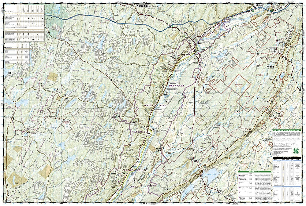
National Geographic Trails Illustrated Delaware Water Gap Map #737 — waterproof, tear-resistant. Coverage of Delaware Water Gap National Recreation Area, the Appalachian Trail corridor, and surrounding lands in New Jersey and Pennsylvania. GPS-compatible.
The National Geographic Trails Illustrated Delaware Water Gap Map covers the Delaware Water Gap National Recreation Area spanning the New Jersey-Pennsylvania border. The Appalachian Trail corridor, river access points, swimming areas, campgrounds, and recreation facilities are mapped in detail with trailheads and GPS coordinates.
Key specs
- SKU: NGTI737
- Map number: 737
- Coverage: Delaware Water Gap National Recreation Area (NJ/PA)
- Material: Waterproof, tear-resistant paper
- Features: AT corridor, river access, campgrounds, recreation facilities, trailheads, GPS coordinates
Why it works
Delaware Water Gap is one of the most visited national recreation areas in the US, located within driving distance of New York City and Philadelphia — a detailed map covering the full recreation area with river access, trail, and campground detail is essential for planning visits to this heavily used park. The Appalachian Trail passes through the park, making trail junction and shelter detail important for AT section hikers. Waterproof construction survives the rain and river use common throughout the Mid-Atlantic region.
Ideal for
Hikers, paddlers, campers, and AT section hikers exploring Delaware Water Gap National Recreation Area. See also NGTI1507 (AT Pennsylvania) and NGTI1508 (AT NJ/NY) for Appalachian Trail corridor coverage.
Share