National Geographic
Crater Lake National Park OR Waterproof Topo Map Hiking Camping Trail #244
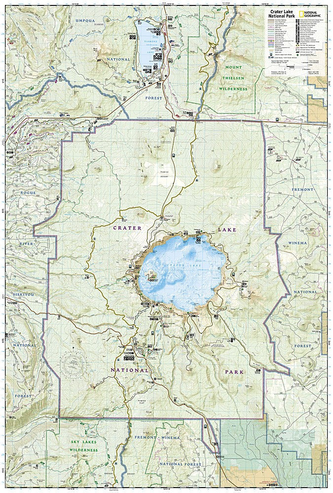
Crater Lake National Park OR Waterproof Topo Map Hiking Camping Trail #244
Couldn't load pickup availability
National Geographic Trails Illustrated Crater Lake National Park Map #244 — waterproof, tear-resistant. Coverage of Crater Lake National Park including Rim Drive, hiking trails, Wizard Island, and surrounding Cascade Range in Oregon. GPS-compatible.
The National Geographic Trails Illustrated Crater Lake National Park Map covers the full park — Rim Drive, the Rim Trail, Wizard Island, the Cleetwood Cove Trail (the only legal access to the lake), backcountry trails, and surrounding Cascade Range terrain. Trails, campgrounds, scenic overlooks, and GPS coordinates are mapped in detail.
Key specs
- SKU: NGTI244
- Map number: 244
- Coverage: Crater Lake National Park, Oregon
- Material: Waterproof, tear-resistant paper
- Features: Rim Drive, Rim Trail, Wizard Island, Cleetwood Cove, backcountry trails, campgrounds, GPS coordinates
Why it works
Crater Lake's caldera rim and surrounding backcountry offer hiking well beyond the popular Rim Drive viewpoints — the Pacific Crest Trail passes through the park and the backcountry trails require detailed mapping for navigation in the Cascade Range terrain. The Cleetwood Cove Trail is the only legal route to the lake shore, making accurate trail detail essential for visitors planning boat tours to Wizard Island. Waterproof construction survives the Cascades' frequent rain and the heavy snowpack that can linger into summer.
Ideal for
Hikers, backpackers, and park visitors exploring Crater Lake National Park's rim, backcountry, and PCT corridor in Oregon. See also NGTI818 (Bend, Three Sisters) for adjacent Cascade Range coverage.
Share