National Geographic
Covington & Alleghany Highlands: Map #788
Covington & Alleghany Highlands: Map #788
Couldn't load pickup availability
National Geographic Trails Illustrated Covington & Alleghany Highlands Map #788 — waterproof, tear-resistant. Coverage of the Alleghany Highlands, George Washington National Forest, Douthat State Park, and surrounding areas in western Virginia. GPS-compatible.
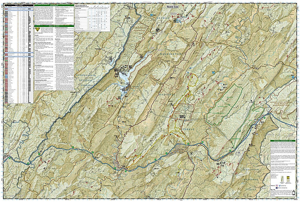
The National Geographic Trails Illustrated Covington & Alleghany Highlands Map covers the Alleghany Highlands of western Virginia including the George Washington National Forest, Douthat State Park, Lake Moomaw, and the surrounding ridge-and-valley terrain. Trails, forest roads, lake access, trailheads, and GPS coordinates are mapped in detail.
Key specs
- SKU: NGTI788
- Map number: 788
- Coverage: Covington & Alleghany Highlands, Virginia (George Washington National Forest)
- Material: Waterproof, tear-resistant paper
- Features: Trails, forest roads, Douthat State Park, Lake Moomaw, trailheads, GPS coordinates
Why it works
The Alleghany Highlands are one of Virginia's least-visited outdoor recreation areas despite offering excellent hiking, fishing, and camping in the George Washington National Forest — a detailed topo map is essential for navigating the forest road network and finding trailheads in this rural area. Douthat State Park's trail network and Lake Moomaw's recreation facilities add significant coverage value. Waterproof construction survives the rain and humidity common in the Virginia highlands year-round.
Ideal for
Hikers, anglers, campers, and outdoor enthusiasts exploring the Alleghany Highlands, George Washington National Forest, and Douthat State Park in western Virginia. See also NGTI791 (Staunton, Shenandoah Valley) for adjacent coverage to the north.
Share