National Geographic
Colorado River, Headwaters & Kremmling: Map & Guide
Colorado River, Headwaters & Kremmling: Map & Guide
Couldn't load pickup availability
Waterproof fishing and river recreation map of the Colorado River from its headwaters to Kremmling — topography, access points, fishing sites, rapids, and public lands.
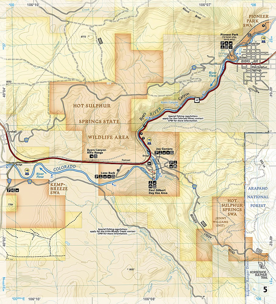
The National Geographic Fishing & River Map 2306 covers the Colorado River corridor from its headwaters near Rocky Mountain National Park downstream to Kremmling, including Gore Canyon and Byers Canyon. Detailed topography, fishing access points, campgrounds, boating sites, and public land boundaries on waterproof, tear-resistant paper with a full UTM grid for GPS navigation.
Coverage includes:
- Colorado River headwaters to Kremmling corridor
- Rocky Mountain National Park western boundary
- Arapaho and Routt National Forests and surrounding public lands
- Gore Canyon and Byers Canyon
- Williams Fork Mountains
- Campgrounds, fishing access points, and boating sites
Key specs:
- SKU: NGFR2306
- Scale: 1" = ½ mile
- Folded size: 4.25" x 9.38"
- Material: Waterproof, tear-resistant paper with stainless steel staples
- Full UTM grid for GPS navigation
- Weight: ~3.2 oz
Why it works:
The Colorado River headwaters section offers exceptional fishing and whitewater in a remote, high-country setting. This map covers the full corridor with the access point, rapid, and terrain detail needed for planning float trips, fishing excursions, and backcountry camping along this stretch of the river.
Ideal for: Anglers, rafters, kayakers, and campers exploring the Colorado River from its headwaters to Kremmling. See also NGFR2307 for the Kremmling to Glenwood Springs section.
Share