National Geographic
Cloud Peak Wilderness: Map #720
Cloud Peak Wilderness: Map #720
Couldn't load pickup availability
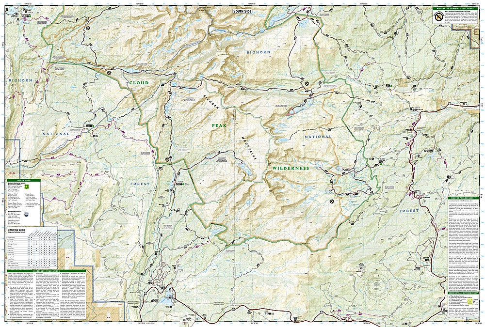
National Geographic Trails Illustrated Cloud Peak Wilderness Map #720 — waterproof, tear-resistant, scale 1:63,360. Coverage of the Cloud Peak Wilderness in the Bighorn Mountains of Wyoming. GPS-compatible.
The National Geographic Trails Illustrated Cloud Peak Wilderness Map covers the Cloud Peak Wilderness in Wyoming's Bighorn Mountains — including Cloud Peak (13,175 ft), the highest point in the Bighorns, alpine lakes, and the surrounding Bighorn National Forest. Trails, wilderness boundaries, alpine lakes, trailheads, and GPS coordinates are mapped in detail.
Key specs
- SKU: NGTI720
- Map number: 720
- Scale: 1:63,360
- Coverage: Cloud Peak Wilderness, Bighorn Mountains, Wyoming
- Material: Waterproof, tear-resistant paper
- Features: Trails, Cloud Peak routes, alpine lakes, wilderness boundaries, trailheads, GPS coordinates
Why it works
The Cloud Peak Wilderness is one of Wyoming's premier backcountry destinations, offering high-alpine terrain, excellent fishing in dozens of alpine lakes, and the challenge of Cloud Peak's summit — all within a wilderness that sees far less traffic than the more famous Wyoming ranges. The dense network of alpine lakes requires detailed mapping to navigate between them efficiently. Waterproof construction survives the Bighorns' afternoon thunderstorms and the early-season snow common at high elevations.
Ideal for
Backpackers, anglers, mountaineers, and wilderness lovers exploring the Cloud Peak Wilderness in Wyoming's Bighorn Mountains.
Share