National Geographic
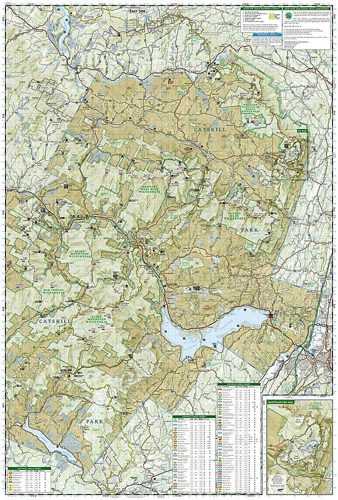
Catskill Park: Map #755
Catskill Park: Map #755
Couldn't load pickup availability
National Geographic Trails Illustrated Catskill Park Map #755 — waterproof, tear-resistant. Coverage of Catskill Park including the Catskill Center, Slide Mountain Wilderness, and surrounding state forest preserve in New York. GPS-compatible.
The National Geographic Trails Illustrated Catskill Park Map covers the full Catskill Park in New York including the Slide Mountain Wilderness, the Catskill 3500 peaks, the Long Path, and surrounding state forest preserve lands. Trails, lean-tos, trailheads, and GPS coordinates are mapped in detail.
Key specs
- SKU: NGTI755
- Map number: 755
- Coverage: Catskill Park, New York
- Material: Waterproof, tear-resistant paper
- Features: Trails, Catskill 3500 peaks, Long Path, lean-tos, trailheads, GPS coordinates
Why it works
The Catskills are one of the most accessible wilderness areas from New York City, attracting hikers pursuing the Catskill 3500 Club's 35-peak challenge and weekend backpackers seeking lean-to camping within a few hours of the city. The park's complex trail network and the Catskill 3500 peak locations require a detailed map that covers the full park in one sheet. Waterproof construction survives the Catskills' frequent rain and the wet conditions common on the higher summits year-round.
Ideal for
Hikers, backpackers, and Catskill 3500 peak baggers exploring Catskill Park's trails and wilderness areas in New York. See also NGTI750 (Shawangunk Mountains) for adjacent coverage to the south.
Share