National Geographic
Carlsbad Caverns National Park NM Waterproof Topo Map Hiking Camping #247
Carlsbad Caverns National Park NM Waterproof Topo Map Hiking Camping #247
Couldn't load pickup availability
National Geographic Trails Illustrated Carlsbad Caverns National Park Map #247 — waterproof, tear-resistant. Coverage of Carlsbad Caverns National Park including cave tour routes, surface hiking trails, and surrounding Guadalupe Mountains in New Mexico. GPS-compatible.
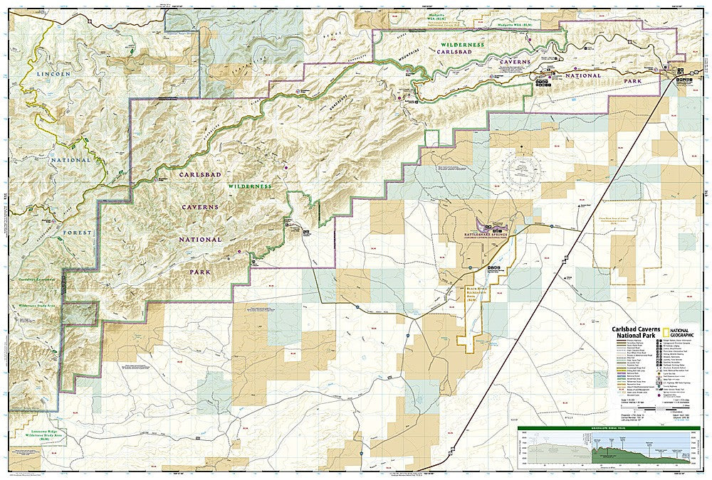
The National Geographic Trails Illustrated Carlsbad Caverns National Park Map covers the full park — the cavern tour routes, the Natural Entrance and Big Room, surface hiking trails in the Guadalupe Mountains, and surrounding desert terrain. Cave access, surface trails, campgrounds, and GPS coordinates are mapped in detail.
Key specs
- SKU: NGTI247
- Map number: 247
- Coverage: Carlsbad Caverns National Park, New Mexico
- Material: Waterproof, tear-resistant paper
- Features: Cave tour routes, surface trails, Guadalupe Mountains, campgrounds, GPS coordinates
Why it works
Carlsbad Caverns is one of the most visited national parks in the Southwest, but the surface hiking trails in the Guadalupe Mountains above the caverns are far less known and require detailed mapping to navigate in the desert terrain. The cave tour routes and access points are useful for planning visits to the different cave sections. Waterproof construction survives the Chihuahuan Desert's heat and the occasional rain that can make desert trails slippery.
Ideal for
Cave tour visitors, hikers, and park visitors exploring Carlsbad Caverns National Park and the surrounding Guadalupe Mountains in New Mexico. See also NGTI247 for adjacent Guadalupe Mountains National Park coverage.
Share