National Geographic
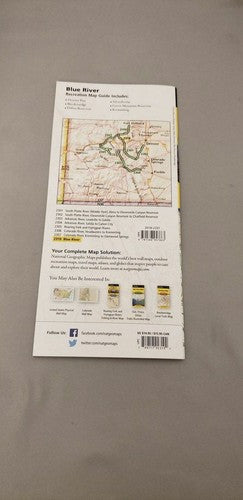
Blue River: Map & Guide
Blue River: Map & Guide
Couldn't load pickup availability
Waterproof fishing and river recreation map of the Blue River, Colorado — topography, access points, fishing sites, rapids, and public lands.
The National Geographic Fishing & River Map 2310 covers the Blue River corridor in Summit County, Colorado — one of Colorado's premier Gold Medal trout fisheries — from Dillon Reservoir downstream through Silverthorne and Kremmling to its confluence with the Colorado River. Fishing access points, campgrounds, public land boundaries, and river features on waterproof, tear-resistant paper with a full UTM grid for GPS navigation.
Coverage includes:
- Blue River corridor from Dillon Reservoir to Colorado River confluence
- Gold Medal fishing water through Silverthorne and Kremmling
- Arapaho National Forest and surrounding public lands
- Fishing access points, campgrounds, and recreation sites
- Public vs. private land boundaries
Key specs:
- SKU: NGFR2310
- Scale: 1" = ½ mile
- Folded size: 4.25" x 9.38"
- Material: Waterproof, tear-resistant paper with stainless steel staples
- Full UTM grid for GPS navigation
- Weight: ~3.2 oz
Why it works:
The Blue River is one of Colorado's most productive and heavily fished Gold Medal tailwaters, with significant public access complexity due to private land interspersed along the corridor. This map clearly shows public access points and land boundaries — essential information for legal, productive fishing on the Blue.
Ideal for: Fly fishers, anglers, and kayakers targeting the Blue River's Gold Medal trout water in Summit County, Colorado.
Share