National Geographic
Black Hills National Forest South SD Waterproof Topo Map Hiking Camping #238
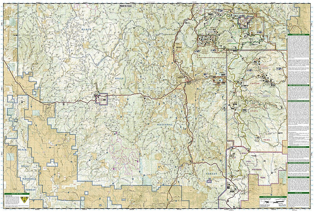
Black Hills National Forest South SD Waterproof Topo Map Hiking Camping #238
Couldn't load pickup availability
National Geographic Trails Illustrated Black Hills National Forest South Map #238 — waterproof, tear-resistant, scale 1:70,000. Coverage of the southern Black Hills including Wind Cave National Park, Jewel Cave National Monument, Custer State Park, and surrounding national forest in South Dakota. GPS-compatible.
The National Geographic Trails Illustrated Black Hills National Forest South Map covers the southern Black Hills — Wind Cave National Park, Jewel Cave National Monument, Custer State Park, Crazy Horse Memorial area, Hot Springs, and surrounding Black Hills National Forest. Hiking, biking, and equestrian trails, campgrounds, scenic byways, and GPS coordinates are mapped in detail.
Key specs
- SKU: NGTI238
- Map number: 238
- Scale: 1:70,000
- Folded size: 4.25" x 9.25"
- Flat size: 26" x 38"
- Coverage: Black Hills National Forest South, South Dakota
- Material: Waterproof, tear-resistant paper
- Features: Trails, Wind Cave NP, Jewel Cave NM, Custer State Park, campgrounds, scenic byways, GPS coordinates
Why it works
The southern Black Hills contain a remarkable concentration of attractions — two national park units, a major state park, and the Crazy Horse Memorial — spread across a large area that requires a detailed map to navigate efficiently between destinations. Wind Cave and Jewel Cave are two of the longest cave systems in the world, and the surrounding trail networks require accurate mapping for hikers and equestrians. Waterproof construction survives the Black Hills' variable weather from summer thunderstorms to early-season snow.
Ideal for
Hikers, equestrians, campers, and visitors exploring the southern Black Hills' national parks, monuments, and state parks in South Dakota. See also NGTIB050 (Black Hills National Forest Bundle) for complete forest coverage.
Share