National Geographic
Black Hills National Forest Bundle (South Dakota)
Black Hills National Forest Bundle (South Dakota)
Couldn't load pickup availability
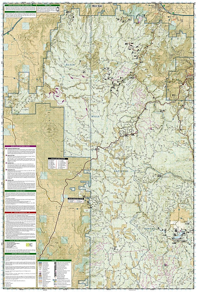
National Geographic Trails Illustrated Black Hills National Forest Map Bundle — waterproof, tear-resistant, detailed topography, trails, scenic byways, and recreation areas. For hikers, mountain bikers, and campers in South Dakota.
The National Geographic Black Hills National Forest Map Bundle includes the Trails Illustrated maps covering the Black Hills National Forest in South Dakota — the Northern Hills and Southern Hills districts, including the Norbeck Wildlife Preserve, Black Elk Wilderness, and surrounding forest lands. Detailed topography, trail networks, scenic byways, and campgrounds on waterproof, tear-resistant paper.
Key specs
- SKU: NGTIB050
- Coverage: Black Hills National Forest, South Dakota
- Material: Waterproof, tear-resistant paper
- Features: Detailed topography, trails, scenic byways, wilderness areas, campgrounds
- Format: Multi-map bundle
Why it works
The Black Hills span both the Northern and Southern districts of the national forest, with very different terrain and trail networks on each end — a bundle covering both districts provides complete coverage without gaps. The forest surrounds Mount Rushmore and Custer State Park, making it a popular destination where trail and road detail beyond what park maps provide is essential. Waterproof construction survives the Black Hills' variable weather from summer thunderstorms to early-season snow.
Ideal for
Hikers, mountain bikers, campers, and road trippers exploring the Black Hills National Forest and surrounding attractions in South Dakota. See also NGTI238 (Black Hills National Forest South) for individual map coverage.
Share