National Geographic
Black Canyon Gunnison National Park CO Waterproof Topo Map Hiking Camping #245
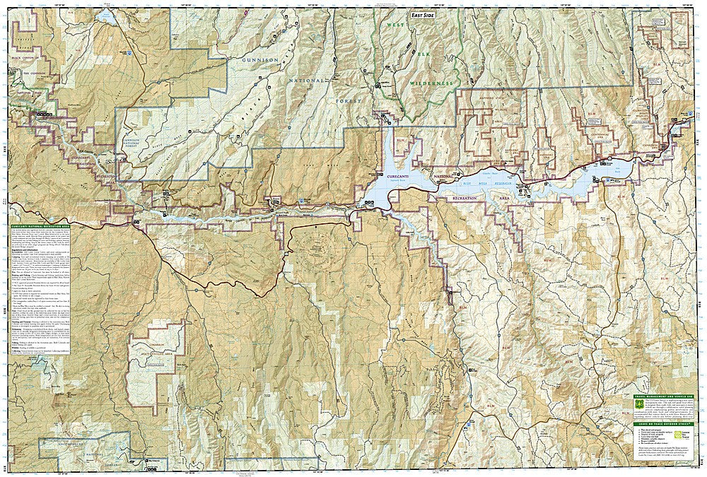
Black Canyon Gunnison National Park CO Waterproof Topo Map Hiking Camping #245
Couldn't load pickup availability
National Geographic Trails Illustrated Black Canyon of the Gunnison National Park Map #245 — waterproof, tear-resistant. Coverage of Black Canyon of the Gunnison National Park, Curecanti National Recreation Area, and surrounding Gunnison Gorge National Conservation Area in Colorado. GPS-compatible.
The National Geographic Trails Illustrated Black Canyon of the Gunnison Map covers the full national park — the South Rim and North Rim, inner canyon routes, Curecanti National Recreation Area, and the Gunnison Gorge National Conservation Area. Rim trails, inner canyon descent routes, campgrounds, and GPS coordinates are mapped in detail.
Key specs
- SKU: NGTI245
- Map number: 245
- Coverage: Black Canyon of the Gunnison NP & Curecanti NRA, Colorado
- Material: Waterproof, tear-resistant paper
- Features: Rim trails, inner canyon routes, Curecanti NRA, campgrounds, GPS coordinates
Why it works
Black Canyon of the Gunnison's inner canyon descents are among the most challenging and committing routes in any national park — the steep, loose terrain and lack of maintained trails make accurate topographic mapping essential for the technical descents to the Gunnison River. The South Rim and North Rim trail networks and the Curecanti NRA's reservoir recreation add significant coverage value. Waterproof construction survives the canyon's variable weather from summer heat to early-season snow on the rims.
Ideal for
Hikers, climbers, anglers, and park visitors exploring Black Canyon of the Gunnison National Park and Curecanti National Recreation Area in Colorado. See also NGTI132 (Gunnison, Pitkin) for adjacent coverage.
Share