National Geographic
Badlands National Park SD Waterproof Topographic Map Hiking Camping Trail #239
Badlands National Park SD Waterproof Topographic Map Hiking Camping Trail #239
Couldn't load pickup availability
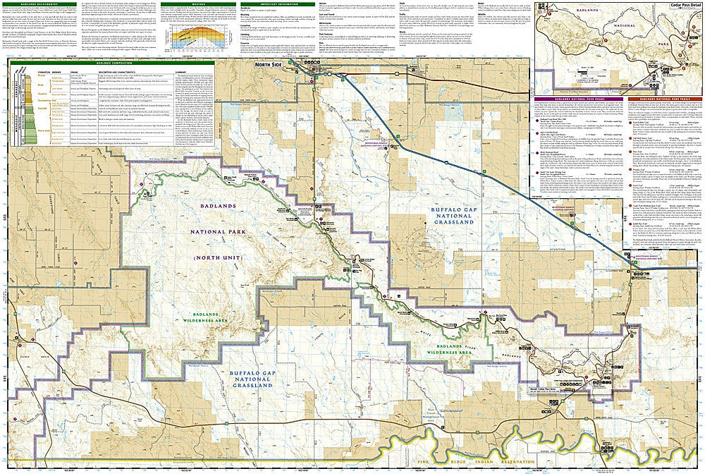
National Geographic Trails Illustrated Badlands National Park Map #239 — waterproof, tear-resistant, scale 1:65,000. Coverage of Badlands National Park including the North and South Units, Sage Creek Wilderness, Buffalo Gap National Grassland, and surrounding areas in South Dakota. GPS-compatible.
The National Geographic Trails Illustrated Badlands National Park Map covers the full park — the North Unit, Stronghold and Palmer Creek Units on the Pine Ridge Reservation, Sage Creek Wilderness, and Buffalo Gap National Grassland. Hiking trails, backcountry routes, campgrounds, scenic overlooks, and GPS coordinates are mapped in detail.
Key specs
- SKU: NGTI239
- Map number: 239
- Scale: 1:65,000
- Folded size: 4.25" x 9.25"
- Flat size: 26" x 38"
- Coverage: Badlands National Park, South Dakota (all units)
- Material: Waterproof, tear-resistant paper
- Features: Trails, backcountry routes, Sage Creek Wilderness, campgrounds, scenic overlooks, GPS coordinates
Why it works
The Badlands' dramatic rock formations, mixed-grass prairies, and fossil beds are spread across multiple park units that require a map covering all sections to plan a complete visit. The Sage Creek Wilderness offers off-trail backcountry hiking in one of the few places in the US where bison roam freely — accurate terrain mapping is essential for navigation in this trackless landscape. Waterproof construction survives the Badlands' extreme weather from summer heat to early-season snow.
Ideal for
Hikers, backpackers, wildlife watchers, and park visitors exploring Badlands National Park's formations, prairies, and wilderness in South Dakota. See also NGTI238 (Black Hills National Forest South) for adjacent coverage to the west.
Share