Benchmark Maps
Road & Recreation Atlas: Alaska
Road & Recreation Atlas: Alaska
Couldn't load pickup availability
The most detailed and accurate atlas available for Alaska — 144 pages of large-scale landscape maps, public land boundaries, and comprehensive recreation guide. 11" x 16" format.
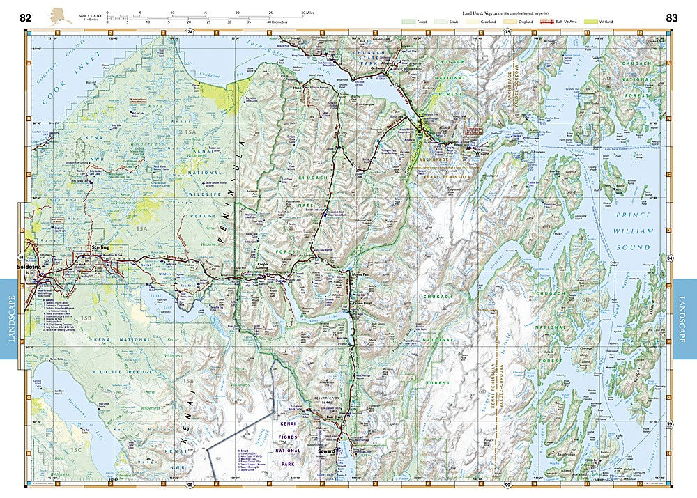
The National Geographic Benchmark Alaska Road & Recreation Atlas is the definitive planning and navigation resource for the Last Frontier. Benchmark field-checkers drove thousands of miles to verify data, making this the most reliable atlas available for Alaska road travel and outdoor recreation. Large-scale landscape maps vividly display Alaska's vast terrain — roads, waterways, landforms, and outdoor landmarks — at two scales (1:95,000 and 1:317,000) for both regional overview and detailed navigation.
What's inside:
- 144 pages of full-color landscape maps at 1:95,000 and 1:317,000 scales
- Field-verified road networks from highways to remote tracks
- Public land ownership boundaries clearly marked
- Enlarged regional sections for clarity and navigation
- Comprehensive recreation guide by category: campgrounds, fishing, hiking, boat launches
- Waterways, rivers, and lakes for fishing and paddling
- Detailed index
Key specs:
- SKU: NGBA000
- Publisher: National Geographic / Benchmark Maps
- Format: Spiral-bound atlas, 11" x 16"
- Pages: 144
- Scales: 1:95,000 and 1:317,000
- Coverage: Full state of Alaska
- Weight: 32 oz (2 lbs)
- ISBN: 9780929591148
Why it works:
Alaska's road network is sparse relative to its size, and navigating between the road system, remote airstrips, river corridors, and public land boundaries requires the most accurate mapping available. Benchmark's field-verified data — verified by driving thousands of miles across the state — makes this atlas the trusted resource for Alaska hunters, anglers, and backcountry travelers who need to know exactly what's on the ground.
Ideal for: Hunters, anglers, hikers, backpackers, road trippers, and outdoor enthusiasts planning trips anywhere in Alaska.
Share