National Geographic
Absaroka Beartooth Wilderness East MT Waterproof Topo Map Hiking Camping #722
Absaroka Beartooth Wilderness East MT Waterproof Topo Map Hiking Camping #722
Couldn't load pickup availability
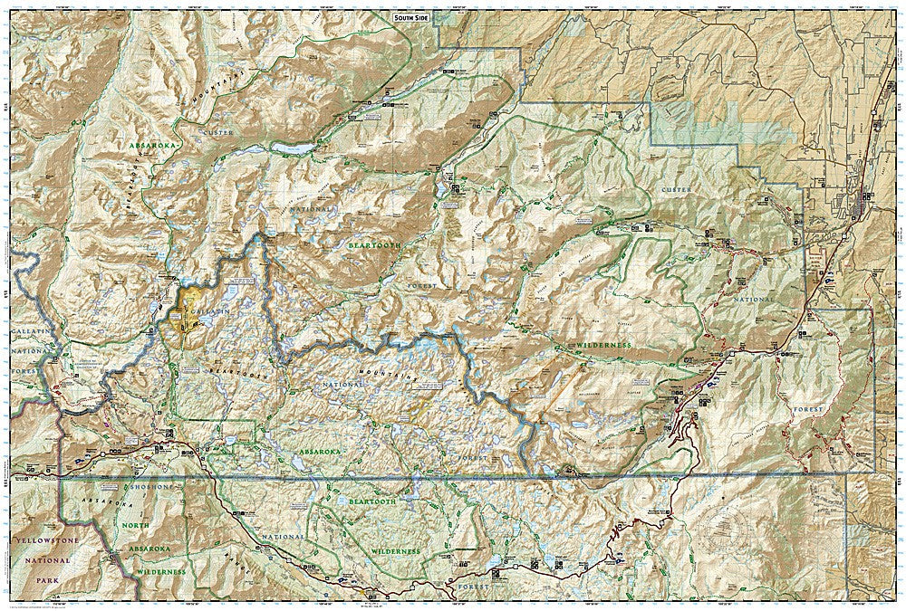
National Geographic Trails Illustrated Absaroka-Beartooth Wilderness East Map #722 — waterproof, tear-resistant, scale 1:63,360. Coverage of the eastern Absaroka-Beartooth Wilderness including Beartooth Pass, Cooke City, East Rosebud Trail, Stillwater River, and Beartooth Highway in Montana. GPS-compatible.
The National Geographic Trails Illustrated Absaroka-Beartooth Wilderness East Map covers the eastern section of the Absaroka-Beartooth Wilderness in Montana — Beartooth Pass, Cooke City, the East Rosebud Trail, Stillwater River drainage, and the Beartooth Highway (US 212). Trails, alpine lakes, wilderness boundaries, trailheads, and GPS coordinates are mapped in detail.
Key specs
- SKU: NGTI722
- Map number: 722
- Scale: 1:63,360
- Coverage: Absaroka-Beartooth Wilderness East, Montana
- Material: Waterproof, tear-resistant paper
- Features: Trails, Beartooth Pass, East Rosebud Trail, Stillwater River, alpine lakes, trailheads, GPS coordinates
Why it works
The eastern Beartooth Wilderness contains some of the most spectacular alpine terrain in the lower 48 states, with the Beartooth Highway providing high-elevation access to trailheads that lead into the plateau's dense network of alpine lakes. The East Rosebud Trail is one of Montana's premier backcountry routes, requiring accurate trail and lake mapping for multi-day trips. Waterproof construction is essential in Montana's high country where afternoon thunderstorms and early-season snow are constant hazards.
Ideal for
Backpackers, anglers, mountaineers, and wilderness lovers exploring the eastern Absaroka-Beartooth Wilderness via Beartooth Pass and Cooke City. See also NGTI721 (Absaroka-Beartooth Wilderness West) for the western section and NGTIB304 (Absaroka-Beartooth Bundle) for complete coverage.
Share