National Geographic
Absaroka-Beartooth Wilderness West: Map #721
Absaroka-Beartooth Wilderness West: Map #721
Couldn't load pickup availability
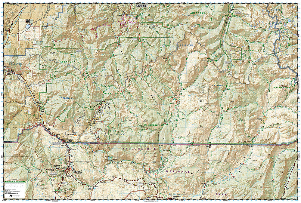
National Geographic Trails Illustrated Absaroka-Beartooth Wilderness West Map #721 — waterproof, tear-resistant, scale 1:63,360. Coverage of the western Absaroka-Beartooth Wilderness including the Stillwater drainage, Slough Creek, and surrounding Gallatin and Custer National Forests in Montana. GPS-compatible.
The National Geographic Trails Illustrated Absaroka-Beartooth Wilderness West Map covers the western section of the Absaroka-Beartooth Wilderness in Montana — the Stillwater River drainage, Slough Creek, the Absaroka Range's volcanic terrain, and surrounding Gallatin and Custer National Forest lands. Trails, wilderness boundaries, backcountry campsites, trailheads, and GPS coordinates are mapped in detail.
Key specs
- SKU: NGTI721
- Map number: 721
- Scale: 1:63,360
- Coverage: Absaroka-Beartooth Wilderness West, Montana
- Material: Waterproof, tear-resistant paper
- Features: Trails, Stillwater drainage, Slough Creek, wilderness boundaries, backcountry campsites, GPS coordinates
Why it works
The western Absaroka-Beartooth Wilderness borders Yellowstone National Park's northeastern corner, with Slough Creek being one of the premier blue-ribbon trout fisheries in the Greater Yellowstone Ecosystem — detailed river access and trail mapping is essential for anglers and backpackers accessing this remote terrain. The Absaroka Range's volcanic terrain and the wilderness's complex drainage system require accurate topographic mapping for safe navigation. Waterproof construction survives Montana's variable mountain weather and the river environment.
Ideal for
Backpackers, anglers, hunters, and wilderness lovers exploring the western Absaroka-Beartooth Wilderness and Slough Creek area in Montana. See also NGTI722 (Absaroka-Beartooth Wilderness East) for the eastern section.
Share